MUZEJ U
MAJDANPEKU * MAJDANPEK MUSEUM
Eneolitski rudnik * Eneolithic mine
Rudna Glava
|
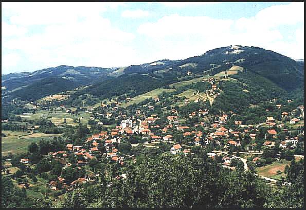
Panorama sela Rudna Glava (pogled s južne strane). Praistorijski rudnik nalazi se na severnoj strani sela, na najvišem brdu - Čoka Oknji, udaljenom oko 2 km od centra sela kroz koji prolazi magistralni put Beograd - Majdanpek - Negotin. Do lokaliteta vodi put koji se redovno održava za lokalne potrebe, i kojim se mogu kretati sva putnička vozila, pa čak i autobusi! Snimio Miroslav Balabanović juna 1999. godine. |
|
This is the view of Rudna Glava settlement (South side view). The area indicated by the rectangle is the area of the pre-historic mine located on the north side of the village, on the highest hill - Choka Oknji, no more than 2 km from the center of the village through which the main connection between Belgrade-Majdanpek-Negotin passes. The road that leads up the hill is in good condition, which means that local buses and vehicles can use it. This photograph was taken by Miroslav Balabanovic, in June 1999. |
|
* |
mailto:muzejmpek@ptt.yu |